


HOME > TOPOGRAFIA
Topografia
TOPOGRAPHIC SURVEY
01
Obtain an accurate plan of your land containing contour lines, buildings, trees, boxes, walls, streets and buildings.


We mobilize a topography team for your project that will implement all the elements of your project with millimeter precision on pickets, pins, flags or templates.
WORKS LEASE
02


LEVELING
Use topography to level land for earthworks or generate deformation and settlement graphs.
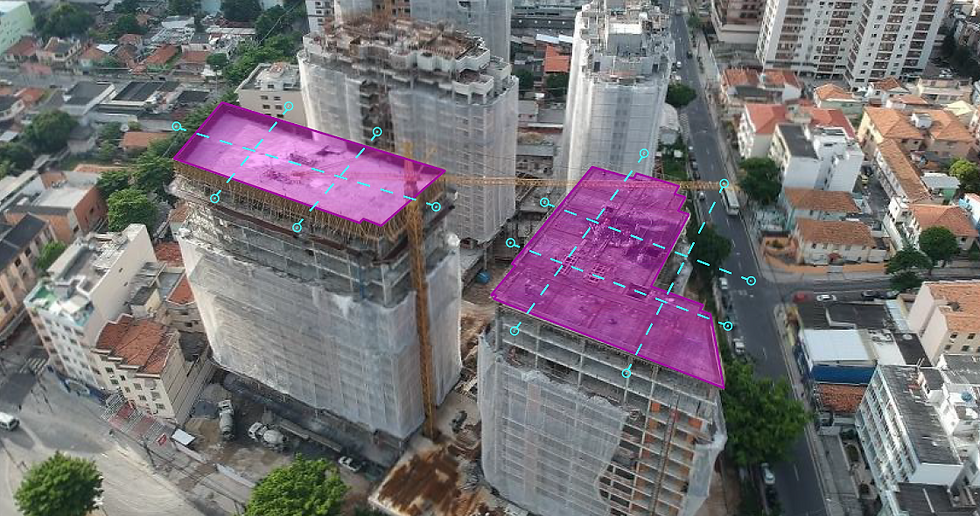
03


AEROPHOTOGRAMMETRY
Get incredible aerial images and topographic maps using our drones.
04

We use high-precision GNSS (GPS) equipment to register global coordinates.
GEORREFERENCE
05

RETROFITING
Survey of internal details of an existing architecture.
06

TREE REGISTRATION
We mobilize a forestry engineer to tag and classify all tree species on your land.
07

TREE REGISTRATION
We mobilize a forestry engineer to tag and classify all tree species on your land.
08
